HISTORY OF CLYDE POND AREA
Early Settlement
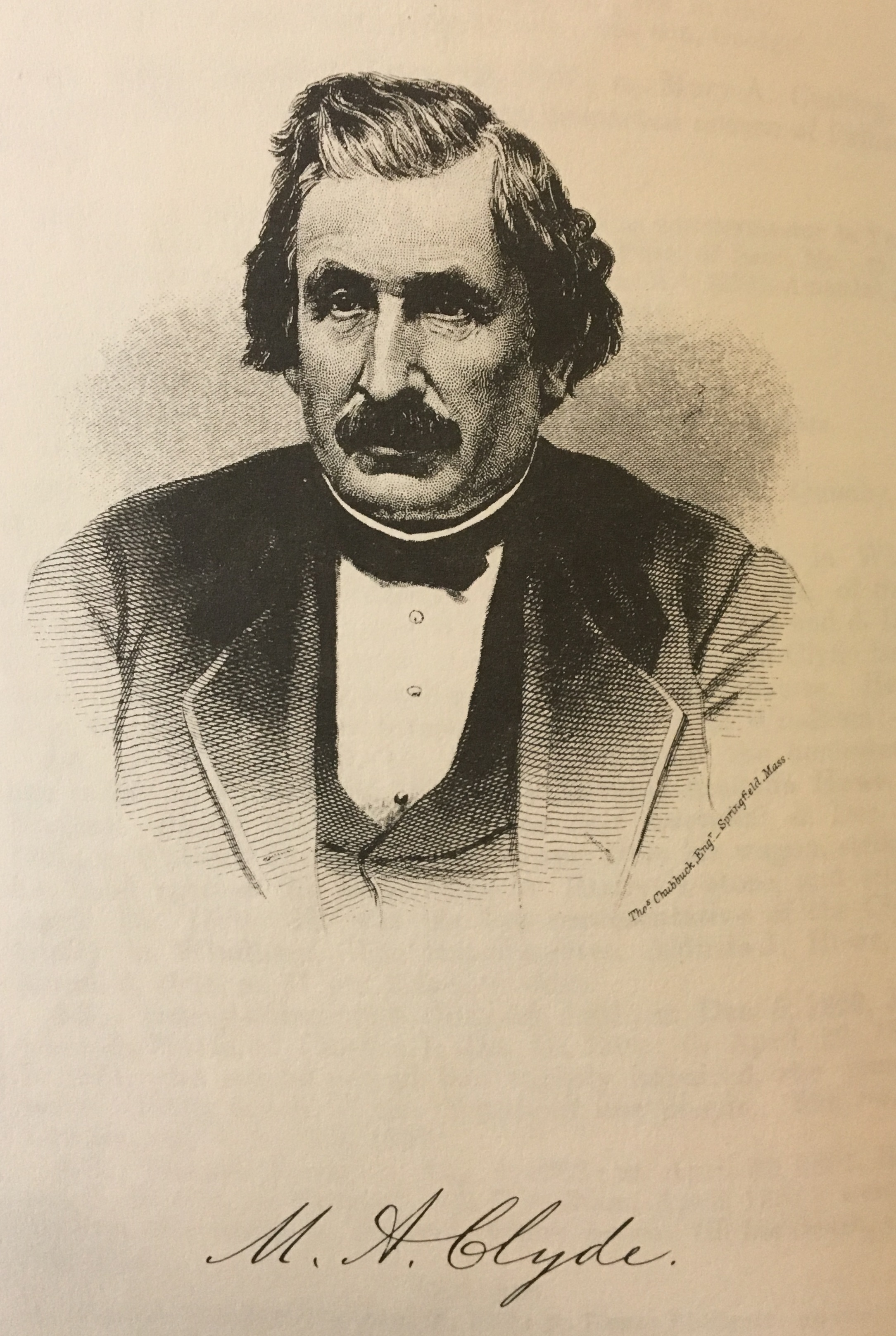
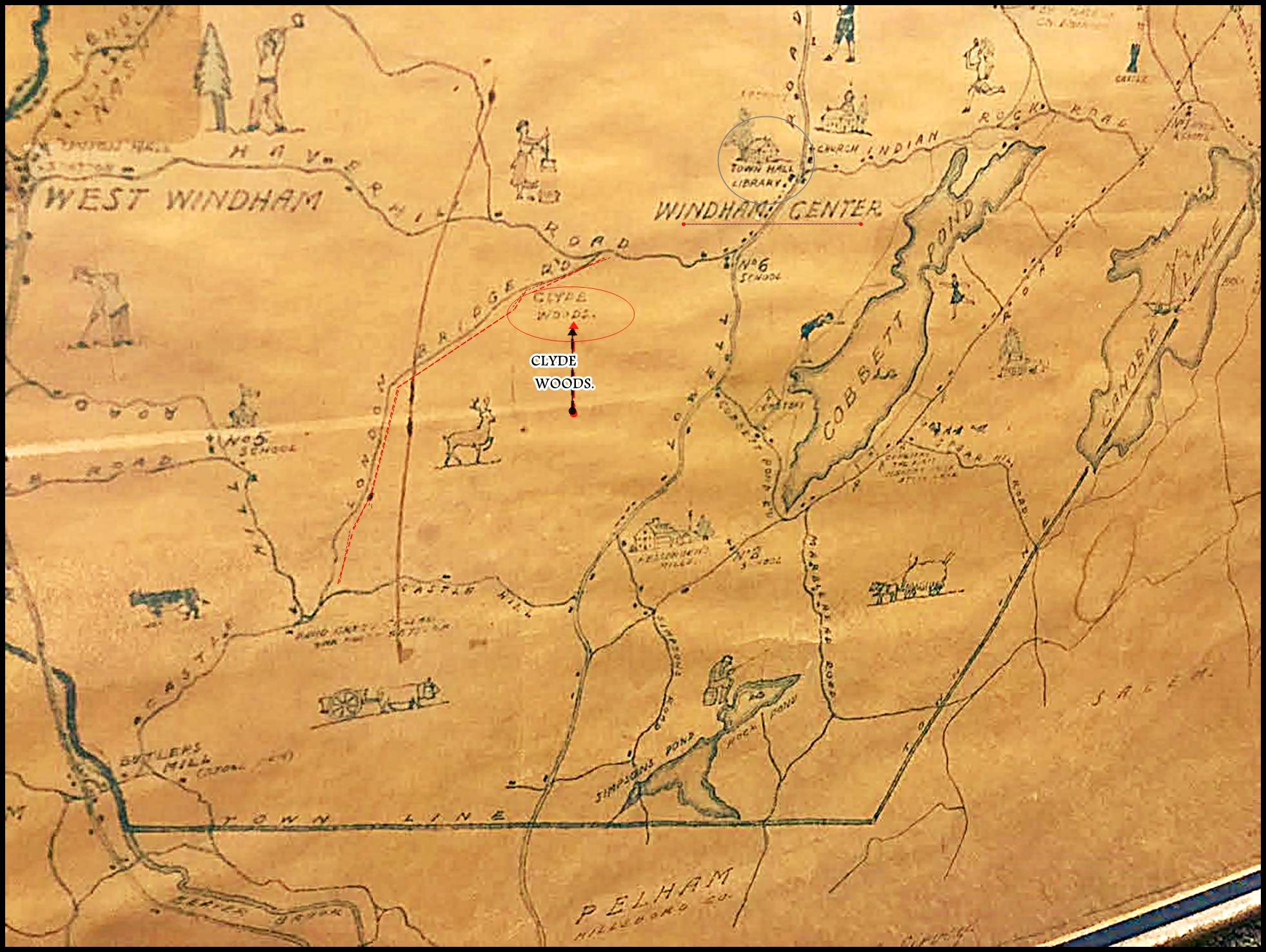
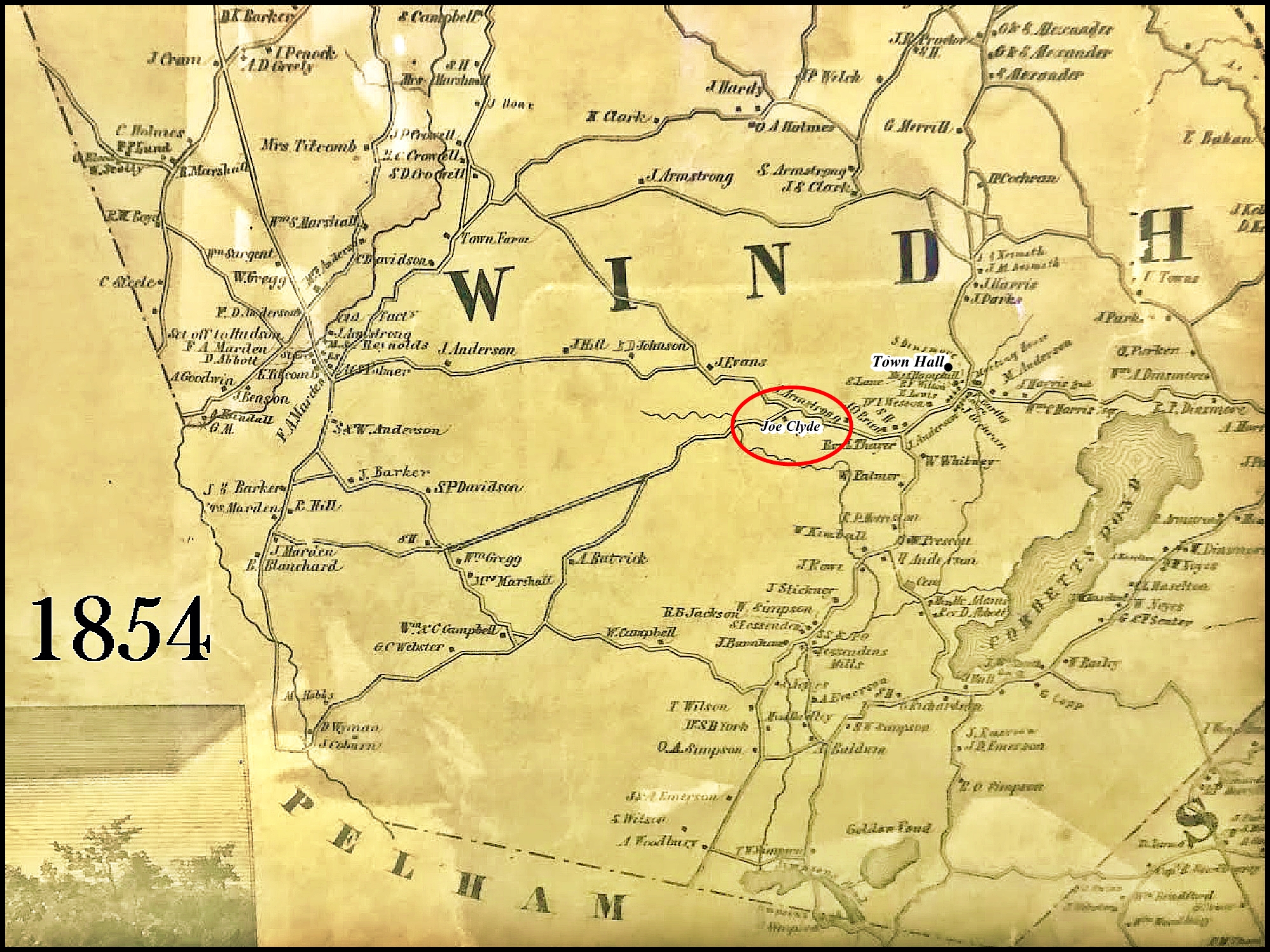
One of the early prominent families in Windham were the Clydes, with a farm at the intersection of London Bridge Road and Haverhill Road as shown on this 1854 map of the town.
What is now Clyde Pond (dug out in the 50s) would have been fields for the farm. The other map shown on this page, shows an area known as ‘Clyde Woods’, likely referring to the adjacent slopes and uphill area from where the farmhouse once stood. The Clyde farm would have been the closest farm to the Sheep Pen still preserved on the Gage Lands, so perhaps their sheep grazed on some of the uplands and they had use of the Pen. The original farm house probably stood where the pond is today or close to it, and the several acres of flat land (now the pond) would have been excellent farm land.
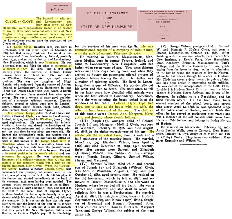
Read more about the incredible Clyde Family- early settlers to this Windham land during the founding of our country. See highlighted excerpts found at the bottom of this page , or explore the full history online here, and here .
Clyde Pond origin and more recent land background The history of the manmade Clyde Pond is shrouded in some mystery. Legend has it that the pond site had been a quarry on more than one occasion, and w as a source of stone for Searles Castle and its walls. Others point out, however, that the printed history points to Searles being built with stone from Lawrence and Methuen.
The biggest problem with the Clyde quarry was that it was highly susceptible to flooding, not due to the runoff from upstream, but because of several springs down deep. It was said that it was common for the workmen to arrive in the morning and have to spend until mid-day pumping out water to get down to where they were cutting stone. Finally, one day the site was completely flooded, and they just quit, abandoning the site. The pond eventually filled up with silt from upstream.
Later, the site might have been one of several locations in Town that were dredged in the 1950’s to generate fill for the original construction of Route 111.
After Route 111 was finished, it was said that pickup trucks would park where the beaver dam is today and swimmers would dive off truck roofs into the water; which quickly falls off to a depth of eight feet.
In the 70’s, it has been said that the trails running through the Clyde lands were at the end of a Mass-to-NH motocross race. That would explain why the trails today often take the most interesting, but not necessarily easiest path, from one point to another. No wonder that mountain bikers enjoy those trails today. In the ‘80’s the pond was used by the Windham Fire Department to practice under-the-ice rescues. On several occasions, hot air balloons used the pond for “touch and go” maneuvers, which must have been challenging given the surrounding hills and trees.
By the late nineties, the land was in the hands of the current owner. Here-cleared all the closed trails, put up the rope swing, stocked the pond, and even had a zip line running across the pond for a while. A canoe was left in the water as a public amenity and remained there for six years, oars and all, before it disappeared when the road construction started.
———–
Read more about the Clyde Family